
Agrandissement
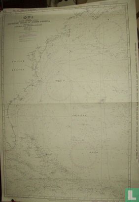
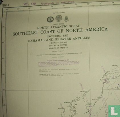
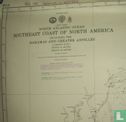
North Atlantic Ocean, Southeast Coast of North America, including Bahamas and Greater Antilles


Descriptif de l'objet
Numéro LastDodo
3432137
Catégorie
Cartes géographiques des pays et globes
Titre
North Atlantic Ocean, Southeast Coast of North America, including Bahamas and Greater Antilles
Type
Fabricant / Éditeur
Pays de publication
Cartographe / dessinateur
Année
1975
Édition
Collection
Numéro dans la collection
Numéro complémentaire
Échelle
Continent
Pays
Zones non indépendantes
Anciens pays et colonies
Région / province
Ville
Matière
Coloration
Langue / dialecte
Thème
Dimensions
ISBN13
ISBN10
Particularités
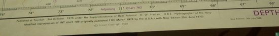
publié à Taunton le 3 oct. 1975 sous la direction du contre-amiral D.W. Haslam, O.B.E., hydrographe de la marine. Reproduction modifiée de INT. graphique 108 initialement publié le 11 mars 1974 par les États-Unis. (avec nouvelle édition le 25 juin 1977). © Copyright de la Couronne 1977.
Ce texte a été automatiquement traduit du Néerlandais
Cliquez ici pour le texte original
published at Taunton 3rd oct. 1975 under the superintendence of Rear Admiral D.W. Haslam, O.B.E., hydrographer of the navy.
Modified reproduction of INT. chart 108 originally published 11th march 1974 by the U.S.A. (with new edition 25th june 1977).
© Crown copyright 1977.